
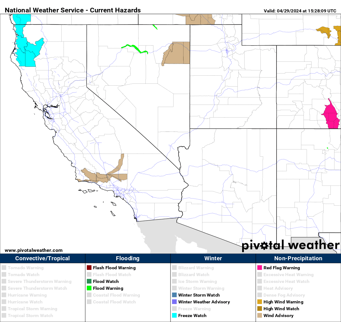
WARNINGS AND HAZARDS
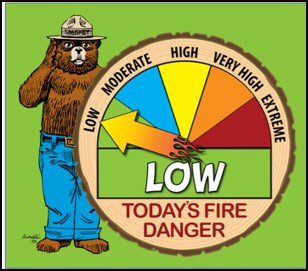
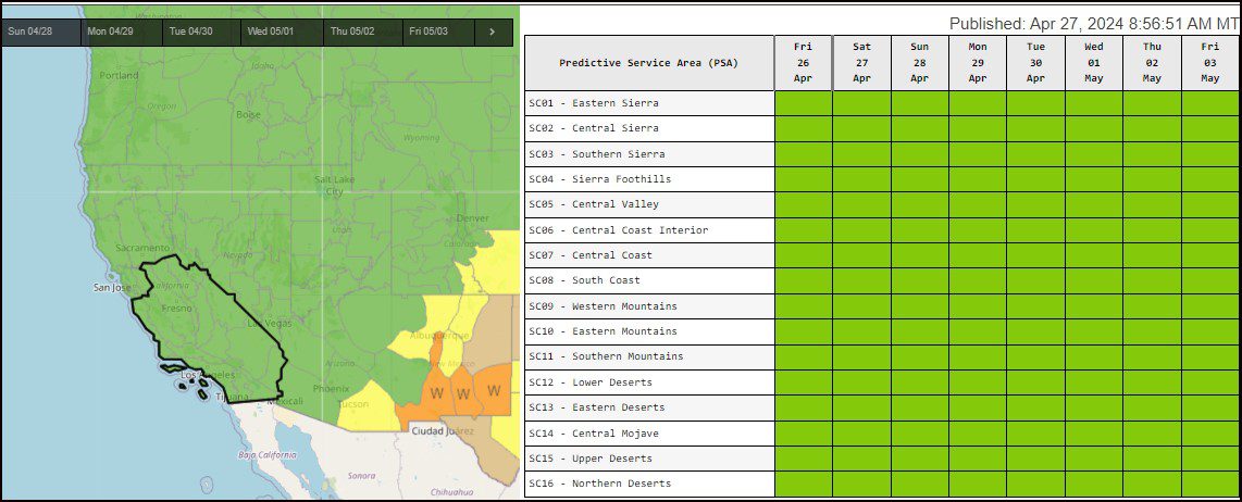
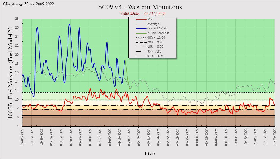
TODAY’S FIRE LEVEL
TODAY’S WEATHER WARNINGS
PACIFIC HURRICANE WEATHER
ATLANTIC HURRICANE WEATHER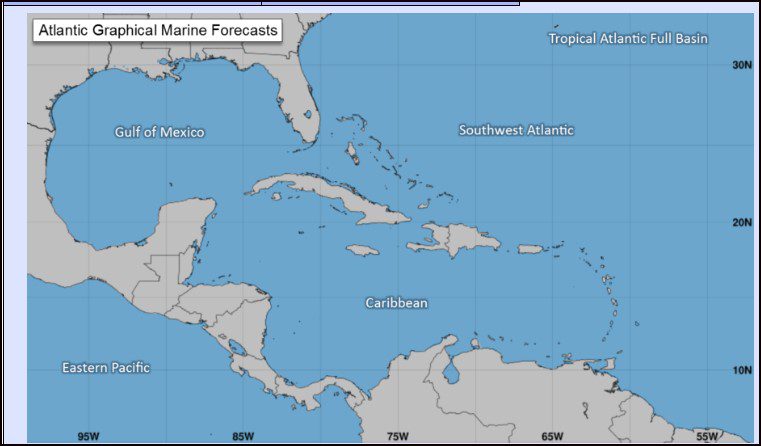
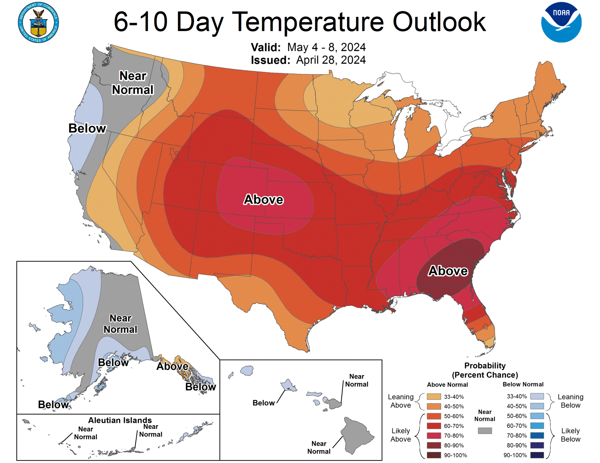
6-10 DAY TEMPERATURE
6-10 DAY PRECIPITATION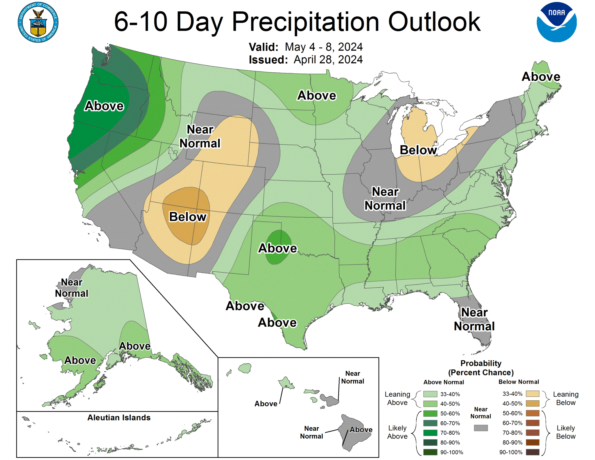
THUNDERSTORM OUTLOOK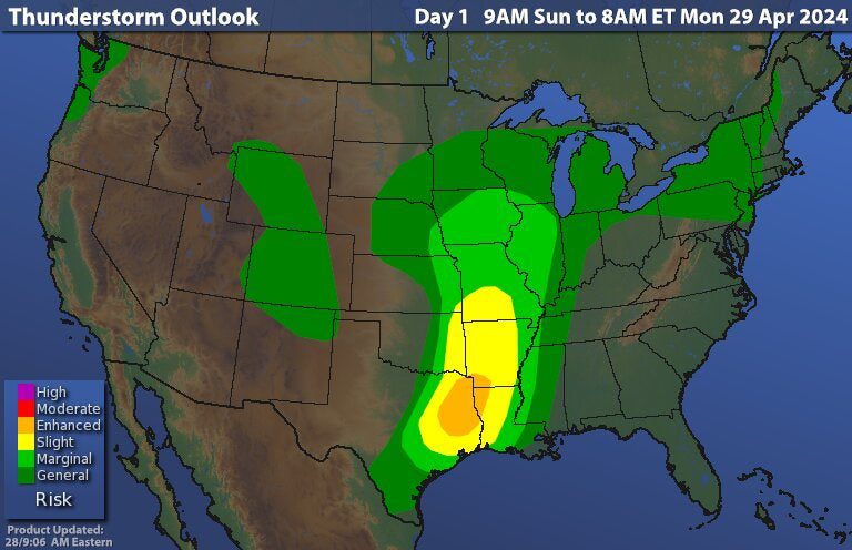
CONUS WEATHER OUTLOOK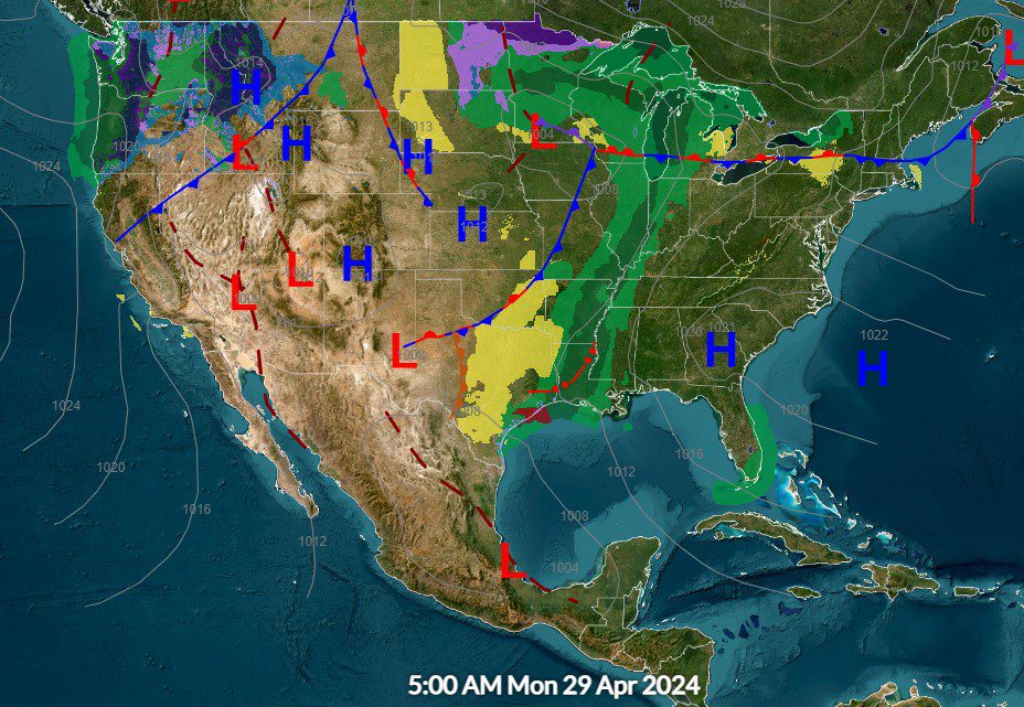
FIRE WEATHER OUTLOOK
FIRE WEATHER FORECAST
FIRE WEATHER FORECAST FOR THE SAN BERNARDINO MOUNTAINS
Weak high pressure will persist across Southern California through Monday evening. A weak trough will move in Monday night and linger over the region through Thursday evening. A deeper trough is likely to move across the area next weekend.
· Temperatures will gradually warm during the middle of next week. Highs early this week are expected to range in the upper 50s to mid 60s for the immediate coast, mid 70s for the Central Valley and Inland Empire and upper 70s to mid to upper 80s for the deserts. Temperatures are likely to warm between 5 and 10 degrees on Wednesday with highs in the mid 60s to low 70s for the coast, upper 70s to mid 80s for the Central Valley and Inland Empire and upper 80s to mid 90s for the deserts.
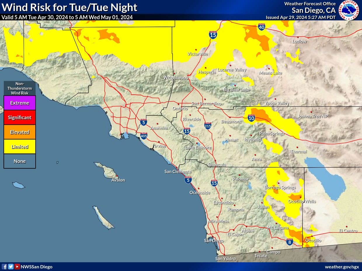
· Weak to moderate onshore flow will continue for most of this week. There is an increasing likelihood of moderate offshore winds from Wednesday evening through Thursday evening.
· Dry weather is expected for much of this week with minimum humidities lowering to around 20 to 40 percent away from the coasts and deserts. Minimum relative humidity below 15% is likely in the deserts this week. There is the potential for minimum relative humidity to fall into the single digits in the deserts mid week onward.
· There is an increasing likelihood of a cooler and wetter pattern returning to Southern California next weekend, however details are still uncertain at this time.