Friday, May 03, 2024
TODAY’S WEATHER DISCUSSION AND FORECAST
..Good Morning.
..This afternoon will be the first Famers Market of the Summer season at the South shore of Lake Gregory.
..Well, today will be the last day of warm and pleasant weather as a cold and windy weather system will arrive tomorrow.
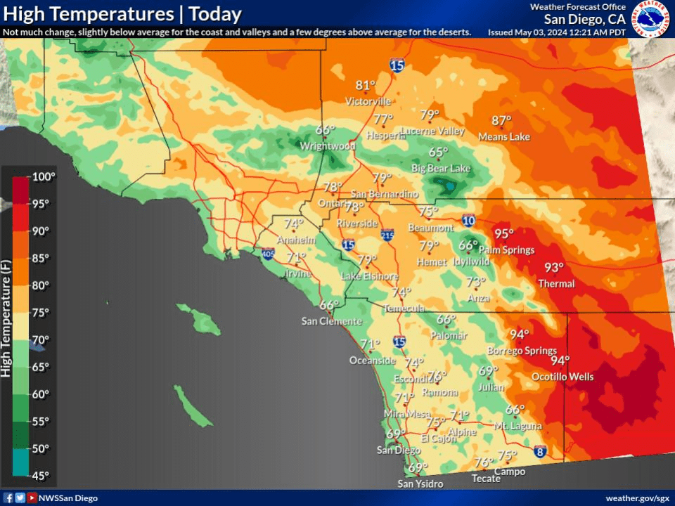
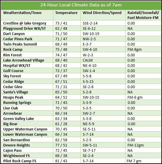
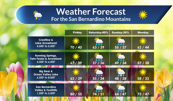
..Temperatures today will be much like yesterday with daytime highs in the upper 60s to 70* today for the Crestline and Arrowhead areas. At the higher elevations of Big Bear, Running Springs and GVL, daytime highs will be a little cooler running in the mid to upper 60s.
..Clear skies today with increasing winds later today will be the day’s weather outlook.
..WIND ADVISORY REMAINS IN EFFECT FROM NOON SATURDAY TO 8 PM PDT SUNDAY.
..San Bernardino County Mountains Including the cities of Crestline, Lake Arrowhead, Big Bear City, Big Bear Lake, Running Springs, Wrightwood, Victorville, Hesperia, Apple Valley, and Lucerne Valley Southwest winds 25 to 35 mph with gusts 55 to 65 mph expected. Isolated gusts to 70 mph near the desert foothills of the mountains late Saturday night.
..LOOKING AHEAD:
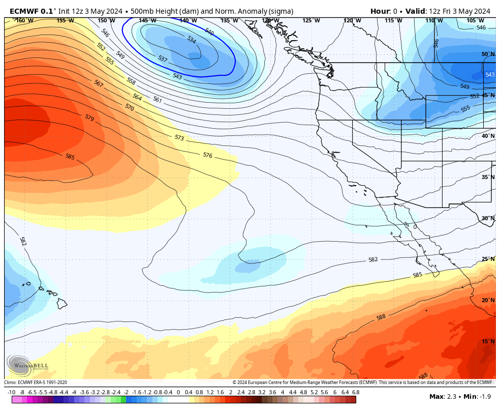
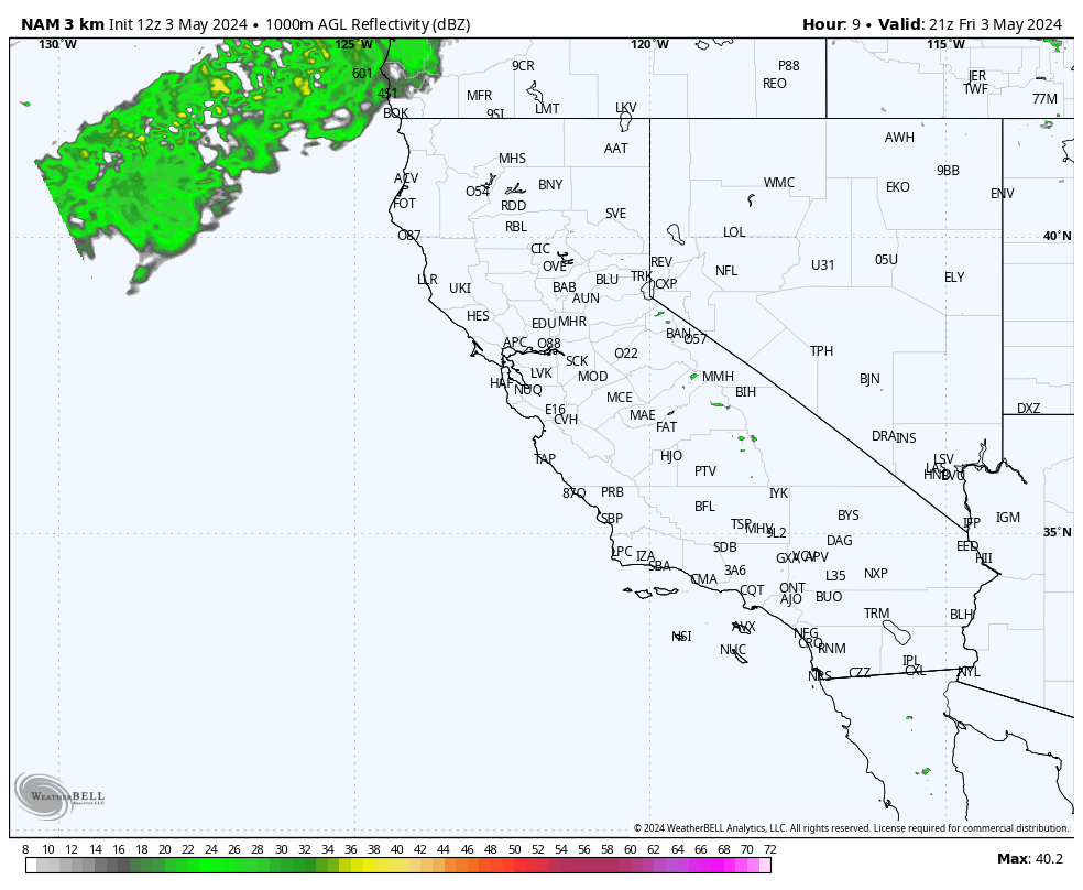
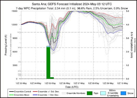
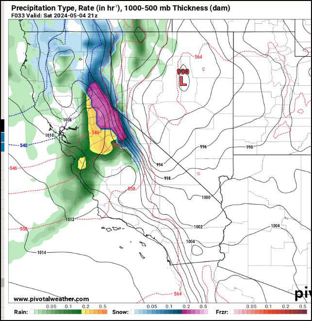
..As we head into the weekend, along with strong and gusty Winds, there will be a chance for light rain showers starting Saturday evening into early Sunday morning. As this is a cold core area of Low pressure, there will be a chance for snow flurries above the 6500-7000′ level by Sunday morning. No measurable snow is expected and rainfall totals are expected to be from .25-.50″ with the greatest amounts along and below the Rim on the West facing slopes. Ridge Fog will develop Saturday morning along the Rim areas then expanding in coverage later in the day lasting through early Sunday afternoon.
..IF, you are headed to the Sierra Nevada Mountains over the weekend, HWY 395 heading North will have strong and gusty winds along with heavy snowfall above the 5000′ level for the Mammoth lakes and or June Lake etc. The weather can get nasty up that way so plan accordingly if you are going that way.
..CRYSTAL BALL OUTLOOK:
..After all of this passes to our East by Monday, we will be under a weak area of High pressure that will be centered over the Pacific to our West, that will put us in a more Zonal flow aloft. Temperatures will begin to warm up again through the work week as it looks now.
..My weather forecasts are derived from what I feel is the most probable outlook for our area. RC